
Valley of Flowers Altitude and Elevation
Published on November 09, 2025 | Updated on August 28, 2026
The Valley of Flowers altitude is approximately 3,600 metres (about 11,800 feet) above sea level, placing this famous Uttarakhand national park firmly in the high-altitude Himalayan zone. Uttarakhand Tourism lists the valley at around 3,600 metres, while 3,658 metres—roughly 12,000 feet—is also commonly quoted for the main valley area.
That difference is not unusual. Valley of Flowers is a large mountain landscape rather than a single point at one fixed elevation, so altitude can vary depending on where a measurement is taken.
For trekkers, the more useful question is not simply “how high is Valley of Flowers?” but how quickly the elevation changes on the journey and how that altitude may affect the body.
This guide focuses specifically on the elevation of Valley of Flowers, Ghangaria and the trekking route, along with practical acclimatisation and altitude-safety information.
Valley of Flowers Altitude at a Glance
| Location | Approx. Altitude |
|---|---|
| Govindghat | Around 1,800 m / 5,900 ft |
| Ghangaria | 3,050 m / 10,000 ft |
| Valley of Flowers | Around 3,600 m / 11,800 ft |
| Commonly quoted main-valley elevation | Around 3,658 m / 12,000 ft |
| Hemkund Sahib | Above 4,000 m / 13,000+ ft |
Ghangaria's elevation of 3,050 metres and the Valley's approximate 3,600-metre altitude are confirmed by Uttarakhand Tourism.
These numbers show why altitude deserves attention even though the Valley of Flowers trek does not reach the extreme elevations associated with major Himalayan expeditions.
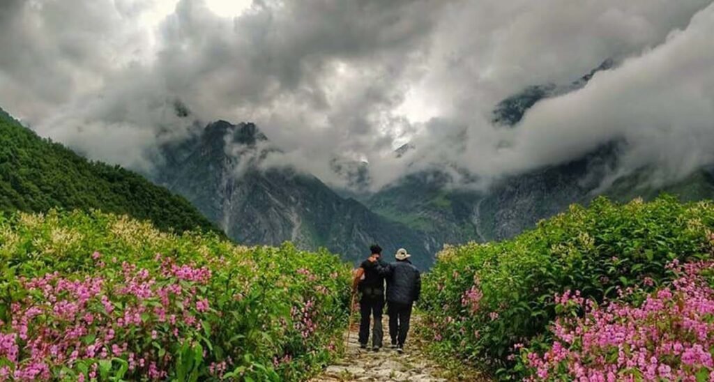
What Is the Exact Altitude of Valley of Flowers?
There is no meaningful single “exact” altitude for the entire Valley of Flowers National Park.
Uttarakhand Tourism describes the Valley as being situated at around 3,600 metres above sea level.
You will also frequently encounter an elevation of approximately 3,658 metres or 12,000 feet in trekking and travel references.
Both figures can be useful as approximate visitor-facing measurements because the Valley is an extensive natural landscape rather than a flat point on a map.
For trip preparation, think of the Valley as a destination sitting at roughly:
3,600–3,650 metres above sea level
≈ 11,800–12,000 feet
That is high enough for unacclimatised visitors to notice the effects of reduced oxygen availability.
Ghangaria Altitude: 3,050 Metres
Ghangaria is one of the most important elevation points on the journey.
The village sits at approximately 3,050 metres (around 10,000 feet) and acts as the main base for visitors heading towards both Valley of Flowers and Hemkund Sahib. Uttarakhand Tourism identifies it as the last inhabited settlement on the route to the Valley.
For trekkers, staying at Ghangaria means spending the night above the 3,000-metre mark before walking higher the following day.
This is one reason Ghangaria should be viewed as more than simply an accommodation stop—it is an important transition point between the lower approach and the higher alpine zone.
How Altitude Changes During the Valley of Flowers Trek

The journey gains elevation in stages rather than taking you directly to 3,600 metres.
Govindghat: Lower Starting Zone
Govindghat is the traditional gateway to Valley of Flowers and Hemkund Sahib. Uttarakhand Tourism confirms that the trek towards Ghangaria begins from here.
Travellers generally arrive here by road before continuing towards the trekking route.
For detailed transport options, road connections and access information, see our guide on how to reach Valley of Flowers.
Ghangaria: Around 3,050 Metres
The next major elevation point is Ghangaria.
Uttarakhand Tourism describes Ghangaria as being approximately 13 km from Govindghat and situated at 3,050 metres.
This substantial elevation gain is one reason trekkers should avoid treating the approach simply as a distance challenge.
Valley of Flowers: Around 3,600 Metres
From Ghangaria, Valley of Flowers is approximately 4 km away according to Uttarakhand Tourism. The trail continues uphill before opening into the alpine valley.
By the time you enter the main Valley area, you are walking at roughly 3,600 metres above sea level.
Valley of Flowers Height in Feet
For travellers more familiar with feet than metres:
3,600 metres ≈ 11,811 feet
The commonly cited figure of:
3,658 metres ≈ 12,001 feet
is therefore often rounded simply to 12,000 feet.
This is why searches for “Valley of Flowers height in feet” may return either approximately 11,800 feet or 12,000 feet. The difference mainly reflects rounding and measurement location rather than two completely different destinations.
Why Does Valley of Flowers Altitude Matter?
Altitude changes the trekking experience in ways that are not always obvious from photographs.
At approximately 3,050 metres, the air pressure and available oxygen are already lower than at sea level. The CDC notes that at around this elevation, inspired oxygen pressure is substantially lower than at sea level, which can affect exercise performance and how quickly an unacclimatised traveller becomes tired.
As a result, you may notice:
- Faster breathing while walking uphill
- Reduced stamina compared with walking at lower elevations
- A need for more frequent breaks
- Slower walking speed
- Greater fatigue after prolonged exertion
This does not automatically mean that something is wrong. Physical performance normally decreases at higher elevations.
However, altitude illness should never be dismissed as ordinary tiredness.
Can You Get Altitude Sickness at Valley of Flowers?
Yes. Altitude illness is possible in the Valley of Flowers region because visitors sleep above 3,000 metres at Ghangaria and climb still higher during the Valley visit.
According to the CDC, unacclimatised travellers who reach sleeping elevations of about 2,450 metres (8,000 feet) or higher may be at risk of altitude illness. Risk depends significantly on the elevation reached, speed of ascent and individual susceptibility.
Early acute mountain sickness can include symptoms such as:
- Headache
- Unusual fatigue
- Dizziness
- Nausea
- Reduced appetite
- Vomiting in some cases
Fitness does not guarantee protection against altitude sickness. Even physically strong trekkers can develop symptoms because susceptibility varies between individuals.
If symptoms appear, do not continue climbing simply because the rest of the group is moving ahead.
How to Acclimatise for Valley of Flowers

The body's short-term acclimatisation response develops over the first several days at altitude. Gradual ascent gives the body more time to adjust to reduced oxygen levels.
For the Valley of Flowers journey:
Maintain a Comfortable Pace
Do not turn the climb into a speed test. A steady pace reduces unnecessary exertion.
Allow Time at Ghangaria
Reaching Ghangaria and immediately pushing higher without adequate recovery may make the journey harder.
Stay Hydrated
Drink water regularly during the trek. Hydration supports normal physical performance, although drinking excessive water does not prevent altitude sickness.
Avoid Excessive Exertion Immediately After Ascent
The CDC recommends keeping exercise relatively mild during the first 48 hours after arriving at high altitude whenever circumstances allow.
Do Not Self-Prescribe Altitude Medication
Some medicines are used for altitude-illness prevention or treatment, but suitability depends on the traveller and itinerary. Discuss medication with a qualified doctor rather than taking it simply because another trekker is using it.
Travellers with heart, lung or other relevant medical conditions should obtain medical advice before undertaking high-altitude travel.
When Should Altitude Symptoms Be Taken Seriously?
A mild headache at altitude deserves attention rather than panic, but worsening symptoms should not be ignored.
CDC guidance says travellers experiencing altitude illness should not ascend to a higher sleeping elevation until symptoms have resolved. If symptoms become worse while resting at the same elevation, descent is advised.
Emergency warning signs can include confusion, loss of coordination, severe breathlessness at rest or rapidly worsening weakness. These require urgent medical attention and descent.
This section is intended as general travel-safety information, not individual medical advice.
Is Higher Altitude the Same as Higher Trek Difficulty?
.webp)
Not necessarily.
Altitude is only one component of trekking difficulty. Distance, gradient, weather, trail surface, fitness and walking duration also influence how demanding a trek feels.
Therefore, this altitude guide should not be used as the sole measure of whether you can complete the trek.
For that specific question, read our detailed guide: Is Valley of Flowers a difficult trek?.
If you are planning your first Himalayan hike, the Valley of Flowers trek for beginners covers fitness and first-timer preparation separately.
Valley of Flowers vs Hemkund Sahib Altitude
Valley of Flowers and Hemkund Sahib share Ghangaria as a common base, but their elevations are significantly different.
The Valley sits at approximately 3,600 metres, while Hemkund Sahib is above 4,000 metres and therefore involves a higher-altitude excursion. Official government information describes Hemkund Sahib as a very high-altitude pilgrimage destination.
That elevation difference is one reason travellers should not assume the two trekking days will feel physically identical.
If your itinerary includes both, use our dedicated Valley of Flowers with Hemkund Sahib travel guide.

How Altitude Shapes the Valley's Landscape
The Valley's high elevation is fundamental to its identity as an alpine ecosystem.
UNESCO recognises Valley of Flowers National Park for its high-altitude Himalayan landscape, alpine meadows and internationally important diversity of Western Himalayan flora.
Rather than covering individual species here, travellers interested in the ecological side of the destination can explore our detailed Valley of Flowers biodiversity and flora guide.
Does Altitude Decide the Best Time to Visit?
Altitude influences snow, temperature and seasonal accessibility, but choosing travel dates involves several additional factors.
Rainfall, flower cycles, trail conditions and seasonal access all matter.
For that reason, month-by-month planning belongs in our dedicated best time to visit Valley of Flowers guide.
For temperatures and rainfall specifically, see the Valley of Flowers weather and climate guide.
Practical Altitude Tips Before Your Trek
Keep these elevation-related points in mind:
- Remember that Ghangaria itself is already above 3,000 metres.
- Walk slower than you would at lower altitude.
- Avoid comparing your pace with other trekkers.
- Take symptoms such as persistent headache or nausea seriously.
- Never continue climbing when altitude symptoms are becoming worse.
- Discuss high-altitude travel with your doctor if you have relevant medical conditions.
- Keep enough flexibility in the itinerary to rest when needed.
For broader trip rules, packing and practical preparation, refer to our things to know before visiting Valley of Flowers.

Frequently Asked Questions
1. What is the altitude of Valley of Flowers?
Valley of Flowers is situated at approximately 3,600 metres or 11,800 feet above sea level according to Uttarakhand Tourism.
2. Is Valley of Flowers 12,000 feet high?
Approximately, yes. A frequently used figure is around 3,658 metres, which is almost exactly 12,000 feet. Because the Valley covers a large area, elevation varies across the landscape.
3. What is the altitude of Ghangaria?
Ghangaria is located at approximately 3,050 metres or 10,000 feet above sea level.
4. Is Valley of Flowers considered a high-altitude trek?
Yes. With Ghangaria above 3,000 metres and the Valley around 3,600 metres, travellers enter an elevation where reduced oxygen can affect physical performance and where altitude illness is possible.
5. Can beginners handle the altitude?
Many adequately prepared first-time trekkers visit Valley of Flowers, but previous trekking experience or physical fitness does not eliminate altitude-illness risk. Gradual ascent, sensible pacing and awareness of symptoms remain important.
6. Does Valley of Flowers have the same altitude as Hemkund Sahib?
No. Hemkund Sahib is considerably higher than the main Valley of Flowers area, even though both are accessed from Ghangaria.
Final Thoughts
The Valley of Flowers altitude of around 3,600 metres is an important part of the trekking experience.
Your journey climbs from the lower Govindghat area to Ghangaria at approximately 3,050 metres before continuing into the Valley at roughly 3,600 metres. Understanding this elevation progression helps you set realistic expectations about walking pace, fatigue and acclimatisation.
The goal should not be to worry about the altitude, nor to ignore it. Approach the climb gradually, pay attention to your body's response and give yourself enough time to enjoy the high Himalayan landscape safely.
For official destination information, visitors can also refer to Uttarakhand Tourism's Valley of Flowers guide and UNESCO's information on the Nanda Devi and Valley of Flowers National Parks.


