
Chopta Altitude and Elevation
Published on September 15, 2025
Chopta is a small and peaceful hill station located in the Rudraprayag district of Uttarakhand, India. Known as the “Mini Switzerland of Uttarakhand”, Chopta sits at an altitude of around 2,680 meters, surrounded by lush forests and open green meadows. The area is part of the Kedarnath Wildlife Sanctuary, making it a favorite destination for nature lovers, trekkers, and spiritual seekers. With clear views of the Himalayan peaks like Trishul, Nanda Devi, and Chaukhamba, Chopta offers a truly scenic experience in every season.
Chopta’s fresh air, calm atmosphere, and untouched beauty draw visitors who want a simple but memorable escape from city life. It serves as a base for popular treks to Tungnath Temple, Chandrashila summit, and the beautiful lake of Deoria Tal. Those booking a Chopta Tour Package can enjoy guided walks, comfortable stays, and the perfect mix of relaxation, adventure, and sightseeing. With easy road access from places like Delhi, Rishikesh, and Haridwar, a Chopta tour package is ideal for anyone seeking both spiritual peace and natural wonders in the Himalayas.

Altitude of Chopta: Numbers and Facts
Chopta’s remarkable altitude makes it one of the most scenic and unique places in Uttarakhand. Resting high in the Garhwal Himalayas, this region offers fresh air, spectacular mountain views, and a special environment that attracts both adventure seekers and nature lovers booking a Chopta Tour Package from Delhi or other cities.
Chopta Quick Facts:
-
Located at an altitude of about 2,680 meters (8,792 ft) to 2,709 meters (8,888 ft) above sea level in the Rudraprayag district.
-
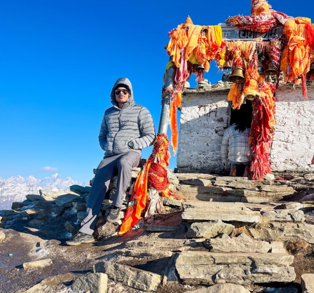
The famous Tungnath Temple, which is the highest Shiva temple in the world, sits at roughly 3,680 meters (12,073 ft).
-
The scenic Chandrashila summit rises to 4,000 meters (13,000 ft), offering 360-degree views of Himalayan peaks.
-
Nearby, the beautiful Deoria Tal lake rests at 2,350 meters (7,710 ft) and is easily accessible from Chopta.
-
Chopta’s meadows and forests support rare wildlife—look for the Himalayan Monal pheasant and musk deer.
Why Altitude Matters:
-
The high elevation means cooler temperatures year-round, with cold, snowy winters and pleasant summers. Winter trekkers on Chopta tour packages can expect thick snow cover December–March.
-
The altitude gives way to surprising biodiversity: alpine flowers, rhododendron forests, and even rare birds.
-
Higher climbs like Tungnath and Chandrashila allow visitors to soak in panoramic views of peaks including Trishul, Nanda Devi, and Chaukhamba—a treat for photographers and spiritual tourists.
-
Those booking Chopta tour packages from Delhi should be prepared for rapid changes in weather and take precautions for altitude, such as staying hydrated and acclimatizing during treks.
Visitors on any Chopta tour package experience true Himalayan heights, breathtaking scenery, and unique adventure—all thanks to this beautiful region’s impressive elevation.
Trekking Heights: Tungnath and Chandrashila
The Chopta Tungnath Trek and Chopta Chandrashila trek offer unique trekking experiences through varied landscapes and significant altitude gains. Unlike flat trails, these treks take hikers from the pleasant meadows of Chopta to the spiritual heights of Tungnath Temple and finally to the breathtaking summit of Chandrashila. Each section challenges trekkers differently but rewards with incredible natural beauty and spiritual significance.
The Tungnath temple trek begins with a relatively gentle ascent along well-defined paths, surrounded by rhododendron and oak forests. The climb to Tungnath is about 4 to 5 km, reaching approximately 3,680 meters above sea level. Tungnath is revered as the highest Shiva temple in the world and serves as both a spiritual destination and a half-way resting point for trekkers heading to Chandrashila.
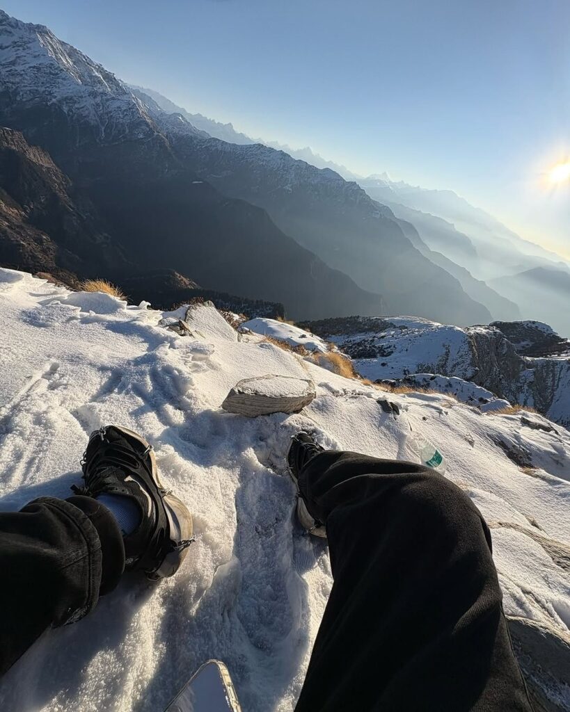
Continuing onward, the Chandrashila trek is shorter but steeper, covering roughly 1.5 km from Tungnath temple to the summit. Chandrashila stands at about 3,950 meters, offering panoramic, 360-degree views of the mighty Himalayan ranges such as Nanda Devi, Trishul, and Kamet. This part of the trek involves a significant altitude gain within a short distance, demanding more effort and stamina. The summit is especially popular for its spectacular sunrise views, where the first rays illuminate the snow-capped peaks in stunning colors.
Key features of these trekking heights include:
-
Gradual ascent from Chopta's base altitude of around 2,680 meters to Tungnath at 3,680 meters
-
Steeper climb from Tungnath to Chandrashila's summit at nearly 3,950 meters
-
Scenic trails through forests, alpine meadows, and rocky paths
-
Spiritual and cultural significance at Tungnath temple, enhancing the trek’s appeal
-
Opportunities to witness diverse flora and fauna adapted to different altitudes
-
Suitable for moderately fit trekkers, with well-marked and manageable trails
These treks are a favorite among adventure seekers and pilgrims alike due to their beautiful natural settings and spiritual highlights. The chopta tungnath trek and chopta chandrashila trek both combine physical challenge with cultural richness, making them a must-do experience for travelers exploring Uttarakhand’s Himalayas. Proper preparation, acclimatization, and pacing are important to fully enjoy the breathtaking views and serene environment encountered on this journey.
Impact of Altitude on Weather
Altitude has a significant impact on the weather in mountainous areas like Chopta and the surrounding regions of the Himalayas. As altitude increases, temperature generally decreases, creating cooler and often more unpredictable weather conditions compared to lower altitudes. This is a key factor for travelers embarking on treks such as the Chopta Tungnath trek or the Chopta Chandrashila trek.
At higher elevations, the air is thinner and holds less heat, so temperatures drop sharply as you ascend. For example, while Chopta village rests at a mild climate due to its moderate altitude, higher points like Tungnath Temple and Chandrashila summit experience much colder temperatures, especially during early mornings, nights, and winter months.
Key effects of altitude on weather include:
-
Temperature Drop: On average, the temperature decreases by about 6.5°C for every 1,000 meters gained in altitude. This means that the summit of Chandrashila can be significantly colder than the base at Chopta.
-
Increased Precipitation: Higher regions in the Himalayas often receive more precipitation, including snow during the colder months, which can lead to treacherous conditions during the winter.
-
Wind and Storms: Altitude exposes trekkers to stronger winds, especially near ridges and peaks, influencing the perceived cold and the difficulty of trekking.
-
Rapid Weather Changes: Weather can change suddenly at high altitude, with clear skies turning into fog, rain, or snow quickly. This demands careful preparation for anyone undertaking the Tungnath temple trek or Chandrashila trek.
-
Thin Air and UV Exposure: The thinner atmosphere offers less protection from ultraviolet rays, making sun protection crucial during daytime treks.
Understanding these conditions is essential when planning a trek in the Chopta region. Proper clothing, acclimatization, and weather awareness help ensure a safe, enjoyable experience amid the stunning Himalayan landscapes. Whether trekking to Tungnath Temple or Chandrashila summit, being mindful of altitude-related weather changes enhances safety and comfort on these majestic journeys.
Best Times to Visit by Altitude
The best time to visit Chopta, Tungnath, and Chandrashila depends on the weather and altitude, which changes across seasons. Planning a trip in the right season makes the Chopta Tungnath trek and Chandrashila summit trek safe and enjoyable.
Best Time to Visit Chopta Tungnath Chandrashila
-
Spring (March to June):
This is one of the best seasons to enjoy clear skies and pleasant temperatures (10-20°C). Rhododendron flowers bloom, adding bright colors along the trail, and wildlife becomes active. Tungnath temple reopens, welcoming pilgrims and trekkers. -
Monsoon (July to September):
Heavy rain can make trails slippery and dangerous, especially near higher altitudes like Chandrashila. Landslides can also happen, so trekking in the monsoon is not recommended unless very experienced and prepared. -
Autumn (October to November):
Clear skies and crisp air make autumn perfect for trekking. Temperatures are comfortable, and the mountain views are stunning. This season is great for photography and enjoying nature. -
Winter (December to February):
Winter is cold with snow covering the trails to Tungnath and Chandrashila, giving a magical look. It’s suitable only for experienced trekkers with proper gear. Day temperatures can be 5-10°C, but night temperatures drop below freezing.
Comparison Table: Best Time to Visit Chopta, Tungnath & Chandrashila
| Season | Weather | Temperature Range | Trail Condition | Suitability | Highlights |
|---|---|---|---|---|---|
| Spring | Pleasant, clear | 10°C to 20°C | Trails clear and safe | Best for beginners & nature lovers | Blooming rhododendrons, clear skies |
| Monsoon | Rainy, slippery | 15°C to 18°C | Slippery, landslide risk | Not recommended | Lush greenery but risky trails |
| Autumn | Cool, clear | 10°C to 15°C | Safe and dry | Ideal for trekkers & photographers | Crisp air, panoramic views |
| Winter | Cold, snowy | 5°C to 10°C | Snow-covered, tough | For experienced trekkers only | Snow trekking, stunning landscapes |
Planning your visit during spring or autumn ensures the best weather and trail conditions for the Chopta Tungnath trek and Chandrashila summit trek. Winter brings snow lovers a thrilling challenge, while monsoon is best avoided for safety reasons.
Places of Interest at Different Heights
Chopta is a unique destination where places of interest vary distinctly with changes in altitude. From peaceful meadows at lower heights to spiritual sites and breathtaking mountain peaks at higher elevations, each level reveals something special for travelers.
Lower Altitude (Around 2,600 – 2,800 meters)
-
Chopta Meadows: Expansive green pastures ideal for camping and nature walks. These meadows burst with wildflowers in spring and summer, offering tranquil spots to relax and enjoy the natural beauty.
-
Deoria Tal: A serene lake nestled at about 2,350 meters, surrounded by thick forests. It’s a popular day-trip destination known for reflective lake views with Himalayan peaks in the background.
-
Ukhimath: Close to Chopta, this town serves as a gateway with temples, local bazaars, and mountain views.
Mid Altitude (2,800 – 3,700 meters)
-
Tungnath Temple: At about 3,680 meters, Tungnath is the highest Shiva temple globally. It offers a spiritual stop for pilgrims and trekkers and stunning views of snow-capped peaks.
-
Rhododendron Forests: Along the path to Tungnath, pristine rhododendron and oak forests provide a colorful and fragrant trek, especially during blooming seasons.
Higher Altitude (3,700 – 4,000 meters)
-
Chandrashila Summit: Reaching nearly 4,000 meters, this summit offers panoramic views of powerful Himalayan peaks like Nanda Devi, Trishul, and Chaukhamba. It is a highlight for adventure seekers and photographers.
-
Alpine Terrain: This region is above the tree line, with rocky paths and alpine flowers that thrive in thin air and cold temperatures.
Each elevation level offers unique experiences — whether it’s peaceful nature walks at Chopta meadows or spiritual fulfillment at Tungnath Temple, culminating with the breathtaking adventure of reaching Chandrashila summit. Exploring these places by altitude makes your journey rich in diversity and scenic beauty.
How to Prepare for High-Altitude Trekking
Preparing for high-altitude trekking like the Chopta Tungnath trek from Delhi or the Chopta Chandrashila Trek from Delhi requires careful planning to ensure safety, comfort, and enjoyment. These treks rise to elevations between 2,600 meters and nearly 4,000 meters, where the air is thinner, temperatures drop, and weather conditions can change quickly.
How to Prepare for High-Altitude Trekking
-
Physical Fitness:
Start training weeks or months before your trek. Focus on cardiovascular exercises like walking, jogging, cycling, and stair climbing to build stamina. Core strength and leg muscles should also be exercised to handle steep climbs and uneven trails. -
Acclimatization:
Acclimatize properly by ascending gradually and including rest days, especially for treks like the Chopta Tungnath Trek from Delhi. Spending time at intermediate altitudes helps your body adjust to lower oxygen levels and reduces the risk of altitude sickness. -
Appropriate Gear:
Wear layered clothing to adapt to temperature shifts—from warm base layers to windproof and waterproof outer layers. Invest in quality trekking boots with good grip and ankle support. Carry essentials like a hat, gloves, sunglasses, and sunscreen to protect against UV rays and cold winds. -
Hydration and Nutrition:
Drink plenty of water throughout your trek to stay hydrated, as dehydration increases altitude sickness risks. Eat balanced meals rich in carbohydrates and proteins to provide long-lasting energy. -
Health Precautions:
Consult a doctor before your trek, especially if you have pre-existing health conditions. Carry a basic medical kit that includes altitude sickness medication, painkillers, and any personal prescriptions. -
Pack Smart:
Keep your backpack light but include necessary items like a first-aid kit, warm clothing, snacks, water bottles, and trekking poles which can help with balance and reduce strain on knees. -
Hire a Guide or Join a Group:
Joining organized tours or hiring local guides for the Chopta Chandrashila trek from Delhi or Chopta Tungnath trek from Delhi ensures safety, local knowledge, and support during emergencies.
Proper preparation will not only make your high-altitude trek safer but also more enjoyable, letting you focus on the beauty, spirituality, and adventure the Chopta region offers.

Surrounding Peaks and Elevations
The region surrounding Chopta is home to some of the most famous and highest peaks of the Garhwal Himalayas. These majestic mountains stand tall, adding drama and beauty to the landscape while offering trekking and climbing opportunities for adventurers. The Chopta Tungnath trek and the Tungnath Temple trek provide perfect vantage points to admire these peaks up close, making the experience even more rewarding for trekkers.
Major Himalayan Peaks Near Chopta and Their Elevations
-
Nanda Devi: At 7,816 meters, it is the second highest peak in India and the highest located entirely within the country.
-
Trishul: This peak climbs to 7,120 meters and is known for its three distinct summits resembling a trident.
-
Chaukhamba: A group of four peaks, with the highest reaching 7,138 meters, forms part of the dramatic skyline.
-
Kedar Peak: Standing at 6,831 meters, this peak is close to significant spiritual sites in the region.
-
Kamet: This towering mountain reaches 7,756 meters and is the second highest peak in Garhwal.
-
Mukut Parbat: At 7,242 meters, it is among the prominent peaks in the region and part of the Kamet group.
-
Satopanth: A high mountain sitting at 7,075 meters, famous for its glacier and surrounding natural beauty.
-
Hardeol: Known as the "Temple of God," this peak rises to 7,151 meters and guards the edges of the Nanda Devi Sanctuary.
-
Tirsuli: Reaching 7,074 meters, it is part of the greater Himalayan chain with challenging climbing routes.
Elevation Range Around Chopta
-
Base village elevation: around 2,680 meters
-
Nearby trekking points rise between 3,500 and 4,000 meters, easily accessible via the Chopta Tungnath trek
-
Higher Himalayan peaks loom over 6,000 to 7,800 meters, visible from various vantage points along the Tungnath Temple Trek
This rich mix of surrounding peaks creates breathtaking panoramic views and challenges for mountaineers. It enhances the trekking experience with diverse landscapes, from green alpine meadows to rocky, snow-covered summits, making Chopta a true Himalayan adventure hub for trekkers undertaking the Chopta Tungnath trek and Tungnath Temple trek.
FAQs on Chopta altitude and elevation
-
What is the altitude of Chopta village?
Chopta is located at about 2,700 meters (8,860 feet) above sea level. -
How high is the Tungnath Temple?
Tungnath Temple stands at 3,680 meters (12,073 feet). -
What is the elevation of Chandrashila Peak?
The summit reaches around 4,000 meters (13,123 feet). -
What is the height difference from Chopta to Chandrashila summit?
The trek climbs roughly 1,300 meters in elevation. -
Is the Chandrashila trek from Delhi suitable for beginners?
Yes, it is moderate and manageable for beginners with basic fitness. -
How long does acclimatization take at Chopta?
Most trekkers adjust well after 1 to 2 days at Chopta. -
What weather should I expect at high altitude?
It is cooler with temperatures dropping as you ascend. -
Can altitude sickness affect trekkers here?
Yes, but proper hydration and pace help prevent it. -
When is the best time for the Chandrashila trek from Delhi?
Ideal months are from March to June and September to November. -
How far is Chopta from Delhi for the Chandrashila trek?
It is about 450 kilometers by road and needs around 10-12 hours travel time. -
Are guides necessary for this trek?
Not mandatory, but recommended for safety and local knowledge. -
What kind of wildlife is seen at these elevations?
You may spot musk deer, Himalayan monal, and various birds. -
How cold is it at the Chandrashila summit?
Temperatures can fall below freezing, especially in winter. -
Are accommodations available in Chopta for trekkers?
Yes, options include guesthouses, campsites, and small hotels. -
Can I book a full Chandrashila trek package from Delhi?
Yes, many operators offer packages including transport, accommodation, and guides.


